A FLORIDA WINTER ~ Hanging Out in Key West

Recalling winters spent in Indiana, I clearly remember as February would wind down, I was more than ready to see winter over and gone.  Cabin fever would have me firmly in its grip and even a hint of warmer days to come was a very welcomed sign.  Of course, those were back in the days when winter meant weeks on end of bitter cold temps and heavily overcast, gray skies.  Now, with the advent of global warming, maybe Midwest winters aren’t so difficult to bear. Perhaps winter days have begun taking on a whole different feeling . . . you’re not counting the days until spring arrives and winter doldrums aren’t something to deal with.  If that be the case, then this post I’m sending won’t be received as pouring salt on one’s open wound.  Or adding an insult to a previous injury.  That these scenes of a tropical paradise and days spent lounging in warm, balmy weather won’t make you envious in the least. It’s for certain that isn’t my intent. Instead, I’m attempting to illustrate what you might find in this place where winter takes on a whole different meaning .  .  .  and where time has a way of slowing down to a pace most people rarely experience.

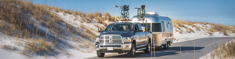
To say it’s an easy drive to reach the far end of the Florida Keys would be not quite accurate.  In fact, the drive can be rather tedious, if not downright arduous.  Definitely lengthier than one might expect.  And then, there can be some stress—at least in the more populous areas that can’t be avoided.  Most travelers seem to have the idea that once past the congestion of Miami, the journey to Key West is nearly over.  To which, those of us who’ve made the trip more than a time or two, would reply “Not by a long shot!”

For us, it was one very long and tiring day of driving as we began just outside of Titusville.  In one fell swoop we were determined to make Key West by the end of the day before nightfall.  And then, once arriving—let those good times roll!

Yes, we’ve made this trip before .  .  .  we’ve visited the Florida Keys since our first experience back in the winter of 2013.  That time went by all too quickly, but it was such a good taste that we easily realized this place definitely rang many of our bells. We knew we’d just have to come back.  My post of that trip captured a little of the essence of Key West and maybe some of the emotional appeal I felt for it.  There’s nothing like experiencing a really good thing for the first time and being able to put it all into words (and photographs).  We actually returned a year later, this time for a longer stay.  Again, I described it in a post, writing more about the historical background and old homes of Key West, rather than the more personal aspects described in that first blog.  Both I think are worth a read, while each having a slightly different slant.

By now, coming to Key West is more like visiting with a favorite relative you’ve known most of your life.  You know their history, their looks are familiar, you enjoy their company, and you just like being with them. This stay in Key West was much like that .  .  .  with time spent just seeing favorite places, revisiting charming back streets and doing what always seemed fitting for such a laid-back, sybaritic place as Key West is.  A place where the phrase “takin’ it easy” has even more significance than most.  The natives simply call it “being on Island Time.”

Leaving mainland Florida behind, traveling the Overseas Highway (a.k.a., US-1) that stretches from Florida City for 125 miles to its end in Key West, I am always struck as if for the first time by that unique color of the water this road crosses over.  In all of our travels throughout our country, we’ve seen nothing that quite measures up.  Art teacher that I was, its color is hard to describe, nearly impossible to pin one word on it.  For today, I’ll call it neon green .  .  .  but maybe that would be changing the next time.  Ephemeral as it is, suffice it to say whatever you call it, the water surrounding the Florida Keys has a way of juicing up my emotions and, like the yellow brick road leading to an extraordinary place, these tropical waters lead to a town like no other.

The history of the Overseas Highway is closely linked to Henry Flagler’s Overseas Railroad constructed in 1912.  When that railroad was severely damaged, and hundreds of people were killed during the Labor Day Hurricane of 1935, government officials were compelled to make the difficult decision to either abandon a land bridge to Key West and the Lower Keys or to transform it into a road.  Ultimately, it was decided that Key West was too important of a town as well as a destination, for several reasons, to remain isolated and basically cut off from the rest of the state, and the nation, for that matter.

In early March of 1937, contracts were written for work on a new Overseas Road and Toll Bridge District.  Restructured beds for Flagler’s train tracks served as the foundations for a new two-lane automotive highway.  On March 29, 1938, the 106-mile-long Overseas Highway officially opened a nonstop thoroughfare for motorists between Miami and Key West.  One journalist for The Wall Street Journal commented that the Overseas Highway was “the only highway in the world by which the motorist actually goes to sea in his car … [providing] one of the most unusual and scenic drives in America.”        https://sah-archipedia.org/buildings/FL-01-087-0035

Some of the original railroad bridges built by Flagler’s crews, still stand today.  No longer part of the Overseas Highway, some sections remain accessible as fishing platforms, others as a walking/biking route.

When completed in 1938, this highway incorporated 42 bridges over the Atlantic Ocean, Florida Bay and the Gulf of Mexico.

This Overseas Highway is considered one of our nation’s modern marvels.  In fact, the Highway was the third largest Public Works Administration project in the U.S. after the Hoover Dam and the Tennessee Valley Authority projects, and it was the largest and one of the last PWA roadway projects completed as part of FDR’s New Deal.

Today, the Overseas Highway is the only All-American Road in Florida.  That’s the highest recognition possible for a highway under the National Scenic Byways program established by Congress in 1991.  Only 30 other roadways in the nation have earned this prestigious title. To earn All-American Road status, a thoroughfare must possess characteristics of national significance and features that don’t exist elsewhere, making it a visitor destination in itself.

And so, we had arrived at one of the most unique places in the U.S.  Where a live-and-let-live attitude, a tropical climate, and seemingly unending happy hours are the vibe du jour.  Where you’ll find an abundance of palm trees with their fronds swaying gently in the offshore breezes and nearly every evening is blessed with a multi-hued sunset.  Welcome to the good life, indeed!

It didn’t take long to settle in and get back into our groove. And soon we were doing the things we like best as we soaked up Key West’s ambiance.  If you’re thinking Key West is all about hitting Duval Street and checking out the bars—think again!

Our modus operandi is more on the lines of shopping a bit . . . eating out a bit more . . . and undertaking a quest to locate the truly best Key lime pie in town . . . firsthand tasting being the preferred way to do it!


Pie-tasting aside, there were other fun activities to occupy our time.  Chris found a Coast Guard ship that captured his interest . . . while I biked through Key West’s Old Town, ogling at all the old homes meticulously renovated.  It’s amazing how well done some of them are!


And when we found ourselves a tad fatigued from all our many Key West doings . . . well, there’s that other noted Key West pastime . . . kicking back, taking it easy, mentally readjusting and to paraphrase a Jimmy Buffett lyric . . . changing the latitudes changes the attitudes .

.  . . and Chris’ attitudes are doing just fine when he’s down in Key West!

Boyd’s Key West Campground hasn’t become so easy to get into . . . in fact, this time around for us it very nearly didn’t happen.  Florida campgrounds, be they public or private, were never very easy to reserve a site during high season’s winter months.  This time around it became an overwhelming, nearly impossible chore.  Finding a site for a short-term interlude (two weeks or less) has recently become not a preference most campgrounds care to deal with.  Instead, it’s the travelers who stay for months on end who are the campers that now receive first dibs on a site.  I guess that’s what most RVers are doing these days when wintering in Florida . . . namely, staying put at one selected resort.  Maybe we have a bit of gypsy traits in us . . . or maybe we’re just a little too restless to stay for a lengthier time.  Whatever the reason, there’s simply no one place in Florida where we could see staying for months.  Consequently, that means it’s a difficult task for us to get into Florida campgrounds.

And Boyd’s Campground is no exception.  They literally use a lottery system to reserve sites—literally drawing site numbers from a hat to reserve in the coming year.  Not able to be present to participate in the draw, we were left to call in each day to see if any site was not chosen.  And so, Chris began his daily ritual, but never lucked out securing a site.

We began thinking we’d seen the last of Key West.  Until Chris wondered if he might luck out with someone’s cancellation.  And so, once again, determined as he was, he began another round of daily phone calls.  And the ladies working in Boyd’s office soon became familiar with Chris Wall.  Not a single day passed that he failed to call . . . and at last it paid off.  In the end, thanks to several cancellations, Chris was able to secure for us a full 11-days’ stay.  And that’s how we managed our Key West destination.  Is it destined to be our last?

To say that campsites in Boyd’s are a tad close together just might be a generous description . . . in truth, most of their sites are downright cramped!  But it’s the only campground that’s close to Key West—an easy 5-mile bike route gets us into town. With that huge convenience, we’ve learned to make the best out of whatever site we’re given.

Jazzed up with outdoor lighting, with bushes and palm trees giving some privacy, we described our site as ‘cozy’.

If writing this post was intended to show how a Key West visit might go, then I can’t close it out without mentioning those Sunset Cruises—which are really a big deal. . . about as big as the sunsets Key West is so famous for.  When put together in one fell swoop . . . then you’ve got the best recipe for tying up the perfect visit.

You could choose from a sunset cruise on a traditional working schooner . . . or maybe a cruise aboard a glass-bottom boat would be more preferable.  How about choosing one of those tall ships where guests are asked to lend a hand . . . or may a “booze cruise” would be more to your liking–sipping wine as the sunset show is happening.  There’s also the pirate ship cruise where a canon is fired (“Aye, matey!!”) and even a Music Cruise that is sure to put you in the Key West spirit.  Whatever swings your ship!

That’s just the magic you find in Key West.

Airstream Travelers,

Melinda and Chris,

~pulling out to see Key West fading away in our rearview mirror.

But will there be a next time?


Posted in Florida, Key West | Tagged , , , | Leave a comment

A FLORIDA WINTER ~ Rare Birds, Big Boats and Rocket Launches

Leaving Savannah, we made our way into Florida as the new year was just beginning.   Regrettably, the Sunshine State seemed to be lacking its main component . . . namely sunshine.  Instead of entering the state to begin our winter hiatus with uplifting spirits in anticipation of wonderfully warm days to come, it was more of an anticlimactic entrance that was not on as high a note as we would’ve hoped for.  Days of overcast skies intermingled with rain over a period of days can readily dampen even the most buoyant of temperaments.   Yet, optimistic as we try to be, we convinced ourselves that these rainy days were a mere blimp in the overall scheme of things.  After all, we were here for the duration . . . long winter weeks in this southern state . . . . of course good weather days were just around the corner.  We would simply wait it out.

In the meantime, we made a beeline for the Space Coast . . .that singular area of Florida where pristine natural habitats and protected areas sandwiched between the Banana River and the Atlantic Ocean are dominated by a sprawling space center; where thousands of seabirds and wide-open stretches of sandy beaches encompass unique ecosystems are within sight of a towering Vehicle Assembly Building and the Launch Control Center as well as rockets that might be positioned on their pads in preparation for upcoming trips into space.

Hwy-A1A is far more the scenic route down Florida’s northern coast, but I-95 is much faster.

We had been to this area before.  Several years ago, we had a cursory look around Cape Canaveral, staying only a couple of days while camped at a county park.  We spent a full day exploring all the offerings of the Kennedy Space Center, of which there were many.  We never had the chance to find what else was nearby, beyond the space complex.  It was one of those places that we made special note of . . . an area that required a more extensive second visit.  And this was the year it came to fruition.

Overcast skies and drizzly days might have dominated our first days, but the tropical foliage and Spanish moss draping from the live oaks’ expansive branches set the scene for the start of our highly-anticipated Florida winter.  Yes Toto, we aren’t in Kansas anymore!


If ever you should follow in our tracks through Florida, I’d tell you to put Jetty Park on your trip.  While not an exceptional camping area, (it wouldn’t make our Top Ten Campgrounds list), what it lacks in the finer points of ample amenities and modern facilities it more than compensates for with its location . . . in more than one way.

(Map credit: GoogleMaps)

Located where the Atlantic Ocean meets the Port Canaveral Inlet, the park is owned by the Canaveral Port Authority and is basically inside the port itself (actually next door to the port terminals).  Approaching its entrance, driving through a somewhat industrial area might be giving you doubts about its attractions, but soon you’ll pass a leafy entrance that’s leads into a park-like setting.  Again, you might feel doubts returning as you take in the park’s sandy roads and close-packed campsites.  But give this place a chance before jumping to any conclusions.

Undoubtedly, the campsites are on the rustic side . . . some of which are not as good (or better) than others.    Some are quite shady and more separated . . . there’s no guarantee of site assignment.  Nevertheless, this is a very popular place and booking early (a year in advance) is definitely the way to go.

We were given one of the perimeter sites, which I think was best suited for any RV that has large windows to the rear—only tropical vegetation was seen outside our windows.

Now, let me sell you on its location.  How about being close to a great sandy beach right on the ocean?  It’s an easy walk from the campground to that beach.  I can tell you firsthand, it’s the perfect place to take your early morning, best-way-to-start-the-day walk.  A prettier beach you’d be hard-pressed to find.

And speaking of walks . . . how about a 1,000-foot jetty leading out into the ocean?  Adjacent to that beach, the jetty is a prime location for watching those cruise ships come and go as well as (take note) THE BEST LOCATION POSSIBLE to watch one of the space center’s rocket launches. (More on that subject soon to follow).

On any ordinary, clear night sky evening, it’s a perfect location for taking in some star gazing . . .  or just to take a last stroll of the day.

But for me, the selling point were the cruise ships as they made their way through the Inlet.  They pass directly in front of the campground—so close that you can see the individual passengers out on the decks.  And hear the festive music playing as it makes its way out to the sea.  Armed with their schedule of daily departures, I never missed being at water’s edge when they passed by.

Whether coming  . . . or going . . . or nearly slamming into the shore, those behemoths held me captivated, wondering how they ever managed to stay afloat?


Cruise ships and space centers aside, this time our stay would be all about what surrounds the area—namely, the wildlife refuges and nature preserves, of which there are several.  One of the best ways to experience these places is to drive at least a segment of the 233-mile-long Indian River Lagoon National Scenic BywayLooping through several barrier islands, the drive passes by some of the most significant natural communities remaining in coastal Florida.  From the national wildlife refuges of Merritt Island on the northern end of the byway to Archie Carr and Pelican Island National Refuges on the southern end, travelers have the opportunity to see some of the most protected wetlands and salt marshes in the state.  It’s promoted as being a haven for nature lovers and a major destination for birding opportunities.

And so, early in the morning of our first day at Jetty Park we were heading out .  .  .  Merritt Island National Wildlife Refuge being our destination.  It was a short 30-minute drive.

Before the 1960s, there was little development on Merritt Island, mainly because the multiple salt marshes in the area had become a haven for mosquitoes.  Once NASA began buying up huge tracts of land for the development of the Space Center and other non-operational purposes, it caught the attention of conservationist groups. Before long, a concerted effort to preserve this major winter migratory bird destination by the National Audubon Society was underway.  A local resident and nationally-renowned ornithologist, Allan Cruikshank, led the effort to protect Cape Canaveral and northern Merritt Island just as the first rocket tests began.  Within a year, a compromise was reached.  Merritt Island National Wildlife Refuge was created, becoming a buffer zone of sorts for what would become the Kennedy Space Center.

Under the auspices of the U.S. Fish and Wildlife Service, Merritt Island NWR contains a wide variety of habitats within its 140,000 acres—coastal dunes, saltwater marshes, scrub, pine flatwoods and hardwood hammocks as well as a visitor center, several hiking trails and one really interesting scenic Black Point Wildlife Drive.  After a visit to the center, we headed out on the Drive.

And that’s when things really got interesting.

To say that Chris was in his element might be a tad understated.  True, it had been quite some time—several months at least—since he had been stalking wild birds with his camera gear.  Perhaps unconsciously he was now thinking that he’d begin by shooting some more cooperative specimens . . . such as this anhinga that practically posed for him .  .  .

.  .  .  and this Wood Stork that he caught strolling across the road.

Having every confidence that he’d soon hit his groove, that his natural ability snagging those spontaneous bird photos would come through, I watched as he became absorbed in his techniques of bird photography.  It’s a beautiful thing watching a person’s passion for something be stimulated again.

And I’d say he came away with some great trophy shots–  –as these photos of the two Tricolored Herons and one Big Blue Heron, all coming together in one afternoon, surely show.

And I knew he’d hit his stride when I saw him go for a Great White Egret in flight.  Perfectly in focus!

And then came the sighting of a bird he’d never snagged (which is becoming harder and harder to accomplish these days).  He can credit me for making the first sighting that directed his attention.


The Reddish Egret is truly a comedic bird, both in looks (his head feathers often are quite disarrayed) and in its actions.  They like to stride through shallow water—only its gait is more like a spontaneous jumping and hopping.  A close friend of Chris’ who’s an avid birder and expert in identifying the various bird species, thinks these egrets resemble drunken sailors as they stagger through the shallow waters.

And then came the highpoint of our afternoon, leaving us both elated over the sighting.  It wasn’t exactly the rarest of birds to come across .  .  .  actually, they aren’t that uncommon in Florida wetlands (although they have been classified as endangered).  It’s more about their coloration—spoonbills come in vibrant shades of pink and red.  But, for us, our sightings of this particular bird have been extremely few and far between.  And when we do manage to find them, it always seems that they’re quite a distance away.  In all the years Chris has been taking bird photos, he’s never come close to having a halfway decent image of a Roseate Spoonbill.

Until this day.

First, it was one lonely Spoonbill perched high on some foliage that caught our attention . . .

.  .  .  and Chris was quick on the draw (or rather, the shot).

But soon afterwards, I happened to spot about a half dozen Spoonbills wading in shallow water nearby.

Wasting little time, Chris kept his composure and went into his shooting mode.

And came away with some pretty remarkable photos.

As Spoonbills age, they’re one of the few birds that actually lose the feathers on their heads and become bald.


With its bright pink feathers, red eyes, bald head and giant spoon-shaped bill, this bird could easily pass as a Dr. Seuss character.  With all its uniqueness and difficulty in finding, maybe you can see why getting photos of this bird is quite the coup.

Our last day at Jetty Park ended on a high note . . . about as high as you’d ever hope to go.  Being so close to the Space Center as we were, it was more than we could’ve hoped for that we’d catch a rocket launch.  But, after a couple of delays and postponements . . .wouldn’t you know one was scheduled on our last evening.  And so, in the darkness of early evening we headed towards the jetty . . . to find a few other campers had the same idea.

Chris had the brilliant thought to use his iPhone to play the live broadcast being sent out from Mission Control.  By doing that, we’d know the exact moment the rocket would take off (or be scrubbed and postponed again).

Not only did we have a live picture, we also could listen to the countdown and the check list going through.  Our anticipation began to build.

So there we were, halfway out on the jetty, when the first indication of a launch came as a flood of light spread across the horizon .  .  .

.  .  .  and then a dazzling circle of light popped above the treetops .  .  .  clearly as sharp and dazzling as the sun rising at daybreak.  What had been pitch black just a few minutes before .  .  .  now lit up the entire landscape with its luminescence.

But there was no accompanying sound of the blast to give the scene reality.  In our fascination and absorption of the event, we never gave the silence any thought.

It wasn’t until the rockets’ tail was about to disappear into a low-hanging cloud, that we heard a faint rumble that began to grow louder and resonate.

We knew what we were hearing .  .  .  and why there was such a delay.

In the next instant the rumble became a roar .  .  .  and the resounding sound waves swept over us—I actually FELT the reverberation in my bones.

It was quite the incredible sensation, giving a fuller meaning to the phrase “. . . . you just had to be there to get the whole effect.”

Bagging (so to speak) an elusive bird and witnessing a rocket launch wrapped up a very good experience at Jetty Park.

             And worth the writing of this blog.

Airstream Travelers,  Melinda & Chris,

. . . streaming away to continue our winter in the tropics.

We hope you’ll want to follow.

Posted in Uncategorized | Tagged , , , , , , | 2 Comments

A FLORIDA WINTER~Where It Began

It’s been a while, I know.  If you’ve been following along with us, it was early October when I last wrapped up our travels along the Lake Huron shoreline in Michigan.  Since that time, an entire fall season came and went, and winter certainly has us in its grips—for some more than others.

As goes our yearly agenda, we didn’t hang around long in Indiana once feeling the first chill of a seasonal change.  As has been our past routine, we were soon on the road . . . our route taking us due south.  Summer clothes packed (biking gear included), itinerary laid in and reservations all set, we were as ready as ready could be.  Loaded to its hilt, our trusty Airstream once again was on the road.  Hoosier Land was soon left behind.

It was a few days before Christmas when we pulled out.  Before reaching Florida, we had plans to spend a few days celebrating the holidays with my sister in Savannah, Georgia.  With us coming from Indiana and her from Florida, Savannah made for a great compromise.  And if you’ve ever seen that historic town decked out for the holidays, then you’d know Savannah is one special place come Christmastime.

Okay, I’m acknowledging here, right up front, it is expecting a lot to hold your attention while I relive our time during the Christmas holidays seeing how February is already more than halfway gone.  Perhaps you can give this post a chance and keep an open mind.  Savannah in December was such a lovely experience .  .  .  such a special town during the holidays, that I feel a need to share just a glimpse of what we saw . . . however untimely it is.

So, why the delay in posting this, you might be asking, and with good cause.  Without going into all the nitty-gritty, suffice it to say that this particular winter getaway of ours didn’t initially get started quite as anticipated.  While managing to stay true to our itinerary and schedule, we both weren’t quite up to par.  As it would turn out, it was more than a week or two before we both finally got totally going and back in our grooves.

But things did go well for us in Savannah and so that is where I’ll begin our story.  Abbreviated for sure, this winter blog of 2024 will hopefully reflect some of the memorable moments and highlights spent in a few of Florida’s most picturesque places.

Chris laid out the outdoor lights to make sure our Airstream suitably reflected the holiday cheer.

And so, here is Savannah .  .  .  a prologue to my winter postings.  Such a unique place to visit any time of the year, but come the Christmas season . . . this town becomes extraordinary.

Daytime in Savannah is the time to take in all the significant and historical sights.  Having meals in some of the many notable restaurants and taking a stroll along the historic Riverfront are two of the activities you’ll want to include.  You’ll learn a lot and see the highlights of Savannah if you include the Hop-On, Hop-Off Trolley Tour on your Savannah agenda. There’s a slightly different tour during the days leading up to Christmas that offers special dividends.  But, book early!

As the evening unfolds and the lights turn on, that’s when Savannah can really shine.  Warm lights glowing from the windows of Savannah’s historic homes sets a mood that’s incredibly romantic.  There are many cobble-stoned streets enticing couples to walk down—that’s something we didn’t miss.  With holiday trim decorating most of these homes, I guarantee you’ll stand and stare . . . each house could be the subject of a Christmas card illustration.

Our last evening in Savannah turned out to be the most magical of all.


After a scrumptious dinner at Vic’s on the River, we were ready for a last walk around the historic district.


Savannah is built around multiple park squares, each one a popular place to stroll. Always nicely landscaped, they’re also decked out with holiday touches.  Being assets to the town, the Squares help to add the charm and character that is distinctively Savannah.

We ended our evening with a stroll on the Waterfront .  .  .


.  .  .  where a heavy fog added a touch of mystery and a sense of timelessness to the atmosphere around us.


This wasn’t our first visit to Savannah, but I say assuredly it was our most memorable.  Perhaps these few photos I’ve included in this post will convince you that this is one town that should be experienced during the Christmas season.


Perhaps you’ll find, as we surely did, that Savannah is the perfect way to put one into the Holiday Spirit.


Airstream Travelers, Melinda and Chris,

heading farther south to escape winter’s chill . . .

.  .  . stay tuned for more to come.

Posted in Georgia, Savannah | Tagged | Leave a comment

STREAMING THROUGH SEPTEMBER—Outstanding Hoeft State Park

In my last post, you might recall, I was on top of a sand dune in Hoeft State Park.  Having risen early, I was there to snag photos of a good sunrise.  But, as kismet occasionally happens, I was caught off-guard, captivated by how light was striking the nearby dunes.  It’s times such as then when conditions are so good, a woman with a camera wishes she could divide herself in two.  Consequently, I missed out on the early sunrise shot.  My first chance had passed .  .  .  but I had three mornings yet to come.

Though dramatic light had faded out, early mornings along a beach can still be subtly rewarding.

As it turned out, the rest of the day saw overcast skies .  .  .  not good enough for much photographing.  A breakfast in town, followed by quiet campfire time, and later, an energetic walk on the beach, all helped to fill the rest of the day. By late afternoon, I found myself restless and ready to break away.  Despite the less-than-perfect light, I decided to have a first look at the nearby lighthouse. If nothing else, I could scout it out and find the best angles for anticipated photo ops.

Forty-Mile Point Lighthouse is less than 3 miles north of Hoeft State Park, just off Rte-23.  Having a lakefront location, it’s aptly named, being 40 miles southeast of the Old Mackinaw Point Light and 40 miles northwest of Thunder Bay Island Light.  Completed in 1896, it has a slightly unusual design being a duplex residence with its 52-foot-high tower built between the two homes.  The lighthouse keeper and his family lived on one side, while the assistant keeper and his family occupied the other.  With the tower in the center, it ideally sound-proofed the two residences.

Wouldn’t you know, after a day of mostly cloudy conditions, as I was arriving at the 40-Mile Point Park, those heavy skies began parting, revealing a slice of blue sky.  Could my luck possibly be changing?

I suppose something’s written in most photography manuals about not giving up on less-than-perfect shooting conditions, about not walking away too soon.  Or, to put it another way, don’t let poor conditions discourage you from trying to take a photo.  Having nothing to lose, I hung around, enjoying the setting, while figuring out which views made the best angle for shooting.  Maybe, before the evening closed down, I’d see better conditions developing . . . and I’d be ready.

In the meantime, the 40-Mile Point Light was a beauty.  With a unique style and obviously well-maintained, I loved her setting and hoped to capture the scene in the best possible light (if I’d ever get some).

There can be a fine line between skies that are too cloudy to produce a good sunset shot and skies that have just the right amount of clouds.  A sky with scattered or diffuse clouds can be a beautiful thing in sunset light, enhancing all the glowing colors in the sky.  Predicting what will happen is a skill that I’m still learning, but sometimes (like this evening), it was just dumb luck that I was there when the show began.

It started slowly . . . and I liked what I saw .  .  ..  .  .  and, in the next moment, the light went crazy glowing.

And when the water and sand caught those golden hues, then I knew I had The Shot.  Afterwards, I could only stand in awe.

And, just when I thought the show was over .  .  .  turning around to head back, would you believe what I saw going down the beach???

There’s another clause in that photographer’s manual that advises . . . “After you take those sunset shots, don’t forget to turn around . . . and keep your camera ready.”

Sometimes, it can really pay off.

I might’ve missed that morning’s sunrise, but this sunset more than compensated for what I didn’t get.  You can be sure that come tomorrow I’d be back again in early morning with my camera ready.  Having lost the chance for a sunrise shot the day before, I didn’t intend to let the coming one slip away.

And so, on the following morning can you understand my abject disappointment as I reached the apex of that same sand dune in the predawn hours and saw what the morning skies looked like?

A sunrise photo op didn’t appear to be too promising.

But, just like yesterday’s sunset, I was to learn that first light can be deceiving.  You’d think by now I’d have some faith that good things might just unexpectedly happen.

That dismal skies might come around . . . that clouds might start to break apart . . .and good light might just find a way to break through.

Morning Two did come through for me . . . in another most excellently good way.In the days to come here at Hoeft State Park you can be sure that I never strayed far from Lake Huron, especially as sunrise and sunset time were approaching.  Our remaining days were fleeting and I hoped to make it all worthwhile.  I’ll share some of the images I captured in those golden hours of day and evening, while filling you in on facts I’ve learned from researching Lake Huron.  I found it all to be enlightening.

Lake Huron is often overlooked compared with the other four Great Lakes. Superior has a reputation as the coldest, deepest and largest. Lake Erie, the warmest and shallowest Great Lake, is a world-renowned fishing ground. Ontario, bookended by the Niagara Falls and St. Lawrence Seaway, is the gateway to the ocean. And, as for Lake Michigan, tourists flock to both Chicago for its remarkable skyline along the shore as well as to the popular small towns along Michigan’s coastline.

Despite its size and pristine waters, Lake Huron has been referred to the “forgotten” Great Lake, mainly because it lacks those distinguishing features of Lake Michigan as well as not having any notable towns along its shores.

Lake Huron was the first among the Great Lakes to be discovered by early European explorers in the region.  The French explorers and trappers often referred to the lake as “la mer douce” (the freshwater sea”).  Most European maps labeled the lake as “Lac des Hurons” (Lake of the Huron natives) and that’s the name that has caught on.

Lake Huron is the third largest freshwater lake in the world, coming just after Lake Superior and Lake Victoria.

Lake Huron has the longest shoreline of the Great Lakes, when counting the shorelines of its more than 30,000 islands.  Lake Huron has a large bay, called the Georgian Bay, on its Canadian side.  The region’s first explorers thought that Georgian Bay was a separate sixth lake because it was separated by the Bruce Peninsula, but it turned out not to be completely cut off from Lake Huron.  With that same reasoning, some scientists and limnologists recognize Lake Huron and Lake Michigan as being one lake because they are connected by the Straits of Mackinac and their waters oscillate back and forth.

Lake Huron has the most irregular shape of any of the Great Lakes, helping it to be the second largest of the Great Lakes by surface area.  The shape of Lake Huron’s shoreline along Michigan is what forms Michigan’s mitten shape.

Many freighters and other seafaring vessels come and go on this “inland sea”.  Lake Huron mainly functions as a conveyer within the Great Lakes system, carrying both water and ships from the other two upper lakes to the urban and industrial centers along the lower two lakes.

Water (and pollutants) flows through Lake Huron faster than the other Great Lakes with a retention time of only 22 years.  (For Lake Superior it’s 191 years and 99 for Lake Michigan).

It was on our last evening of this trip that Chris finally had the opportunity to see the Forty-Mile Point Lighthouse.  The light was reaching its peak of that golden hour when he first saw the lighthouse and I captured the scene in one last image.

With a beautiful evening unfolding, he joined me for one last walk down a Lake Huron beach.

These are the moments we like to remember.

And quite unexpectedly, we encountered the remains of the wreck of a ship, the Joseph S. Fay.  Washed ashore decades ago, the 216-foot bulk freighter was now being buried in the sand.  Someday to be all but forgotten.

Its scenes such as this that really drive home what the term “Shipwreck Alley” truly implies.

While there are fourteen federal marine sanctuaries in the U.S., the only one in the Great Lakes is in Lake Huron.  Thunder Bay National Marine Sanctuary is a 4,300-square-mile preserve near Alpena, Michigan, that holds the remains of 100 known shipwrecks. A combination of rocky shoals and treacherous weather earned the area the nickname “Shipwreck Alley.”  It is suspected that there are another 200 wrecks within or near the boundaries of the sanctuary still remaining to be discovered.

With those thoughts in mind, we continued our walk farther down the beach .  .  .

.  .  .  where I took one last image that I hoped would epitomize some of the essence of the Lake Huron coastline.

And then we turned around to head back .  .  .

.  .  .  just in time to catch a memorable sight.  The full moon (how could I have forgotten???) was beginning to rise above the lake’s horizon.

This might be called “The Sunrise Coast”, but I’d have to say this coastline shines in any light of day .  .  .  or evening.

I guess one could say . . . and I’d have to agree . . . Hoeft State Park can be a magical place.  At least, its magic worked for me.

Airstream Travelers, Melinda & Chris . . .

. . . streaming away from a beautiful trip.

I hope you enjoyed coming along.

Posted in Michigan, Rogers City | Tagged , , , , | Leave a comment

STREAMING THROUGH SEPTEMBER—Rogers City, more than you’d think

Rogers City was just a short distance north of Alpena. (Map credit: http://www.onlyinyourstate.com)

A stay in Rogers City nearly didn’t make the cut.  When planning out our itinerary for this trip, I didn’t see much in that area that would warrant making a stop.  If it wasn’t for the fact that I wanted to add more days to this trip, Rogers City would’ve ended up on the cutting floor.  But once I had learned about the Huron Sunrise Trail being there, that alone sealed the deal.  With a 4-night stay planned at the nearby state park, Rogers City would be our last destination on Route-23.

Having just under 3,000 residents, Rogers City is a small town, to be sure.  Not counting the ghost town of Harrisville, Rogers City would qualify as the smallest town we’ve stay in on our trip.  But once we made a tour through town, we realized early on that Rogers City has made the most of what it has.  For a good start, their downtown was nicely landscaped and having banners and flags lining the main street, it exuded civic pride and a charming town.

Taking obvious pride in being “the Nautical City”, Rogers City was once a booming port town.   With the busy Calcite Port on the southern fringes of town, huge freighters still regularly pull in and out of the harbor.  Working at the port or on a freighter was an occupation for many of the town’s residents, as it still is today.  With the world’s largest limestone quarry connected to Calcite Port, it’s not surprising that it too is a major employer.  Yes, Rogers City isn’t a sleepy little town on Lake Huron . . . things seem to be bustling around here.

As small as the town is, we were lucky there was a campground nearby.  Hoeft State Park was the answer, and once again we’d be relegated to only an electric hookup.  By now we were in the groove of this more primitive camping style and, truthfully, I found it no big deal.  Especially when I was soon to learn what a bonus this park had in store for me.  Honestly, it would turn out to be one of the more significant highlight of our Lake Huron Tour—which will become evident as this post and the next one will illustrate.

P.H. Hoeft State Park, just 4 miles north of Rogers City, was one of the first 14 state parks in Michigan.  The original property was donated by Paul H. Hoeft, who become wealthy through his successful lumbering and shipping businesses.  By the 1920s, the timber business was fading out and Michigan was establishing its state park system at about the same time.  Taking advantage of both situations, Mr. Hoeft donated a large parcel of land bordering Lake Huron for the creation of a new state park.  Later, in the early 1930s, this park was further developed by the efforts of the CCC, which undertook a major reforestation, as well as adding new trails, better roads, and constructing a new bathhouse and one very excellent picnic shelter.  Today, this impressive park with these assets—not forgetting to mention the most incredible lakefront beach—is a real treasure for the public to enjoy.

While not a lakefront site, we had a very large and private location that we enjoyed in many ways.  Evenings spent around our campfire became a nightly pleasure.  Ahhhh, now this is camping!!

Having already mentioned what the big draw to our Rogers City stay might be, I’ll fill you in on details.

“Winding through upland hardwoods, lakeshore dunes, parks and streams, the Huron Sunrise Trail is one of northern Michigan’s most beautiful paved trails.  Connecting the 40-Mile-Point Lighthouse to the north with the South Shore Park to the south, and with a 1.5-mile extension to the Harbor Scenic View overlooking the quarry as well as Calcite Port, it covers all of what is best about this area.”

As I had hoped when planning this Lake Huron trip, biking would be one of our major activities.  As the trip unfolded, we’ve had the pleasure of experiencing some darn good rides.  With equally nice weather conditions to go along with them.  I knew this Huron Sunrise Trail was waiting at the end, and I couldn’t help but have great hopes and expectations that our best ride would be this last ride.  The description of it certainly held promise .  .  .  it seemed to be ringing all my bells.

But sometimes, one’s best hopes and anticipations seem to somehow fall a little short.  Would this be one of those times?

There was only one way to find the answer.  It was a coolish, but sunny day when we set out to do this Big Ride.  Another great asset to this trail was that its route lead straight through our park.  Straight after breakfast, we took off .  .  .

.  .  .  and almost immediately we were biking along the lakefront.  What a view!!

With scenery like this, could any other bike trail be any better???  From the start, it totally won me over.

As described, it wasn’t just about the water views .  .  .  there was lots of diversity to this bike trail.  And given the time of year it was, there would be more scenic surprises ahead that captured my emotions.

Maybe it was experiencing the first fall colors, or the invigorating fresh air .  .  .  but one of us, at least, was feeling an incredible high.

Our destination was the Calcite Port, where I hoped to see the first freighters of this trip.  After all, it couldn’t be a complete Lake Huron experience if I had missed out on seeing at least one big laker (as Great Lake freighters are known).

“Calcite Port (just south of Harbor View Park in Rogers City) is one of 6 great places to view freighters—both lakers and salties—in all of Michigan.  Watch freighters load stone right in front of the world’s largest limestone quarry.”

Holding high expectations, we were headed first to see the quarry and then, nearby, we hoped to see a freighter in port.

When standing on the observation deck, we saw the quarry spread out before us.  Spanning 4 miles long by 1.5 miles wide, it covers nearly 9 acres.  I know, it’s difficult to get a sense of scale, whether in person or in this photo.  More than 150 feet deep, it’s been described a “man-made Grand Canyon”.

The deposits mined here provide the raw material essential to a variety of industries.  The major uses are for various aggregates, road-base stone cement, flux for iron and steel production, railroad ballast, mine dusting, and agricultural lime.  Is that more information than you needed to know?

From there, it was on to the nearby port.  Biking up to the security entrance gate, I inquired from the guard when the next freighter was due in port, only to be informed it was when we had tonight’s dinner reservations.  Arrrgh!!!  But then, when I learned that the Harbor Viewing Area was quite a distance from where the action was, I decided I’d do better to look at the loading process online.  Still disappointed, we began biking back to camp.

Quite by happenstance or maybe good luck, once biking to the lakefront what should we see on the horizon???

Undoubtedly, it was the expected freighter .  .  .  but it was way ahead of schedule!!!  Too late to turn back, I stuck to my plan to learn about the loading of calcite online.

(The following photos are all credited to www.inlandmariners.com – a very good site for learning all you want to know about what goes on at the Calcite Port).

The busy port of Calcite working the stockpiles of limestone quarried at Rogers City .  .  .

.  .  .  to a laker being loaded in port.

When Rogers City’s Calcite Plant opened in 1914, it took over 35 hours of backbreaking shoveling to load a small ship with just over 2 tons of limestone.  Today, a massive modern freighter can be loaded with 25,000 tons of stone and then headed back out of port in 12-14 hours.

Limestone falling off of the shiploader conveyor belt into the freighter’s cargo hold.

More or less centrally located on the northern end of Lake Huron, the freighters leaving Calcite Port are bound for various ports located around the Great Lakes.  Duluth and Buffalo were two that were mentioned to us.

Biking might’ve been the biggest draw that brought us here to Rogers City, but it was not the only attraction I had discovered that would appeal to us.  Our biking day might be concluded, but the following day we’d hit the hiking trail.  And naturally, there was a good one just waiting for us to take.

While a waterfall is the prime destination here within the Mackinaw State Forest, the diversity of hiking trail loops is sure to attract any nature lover to this location.  You’ll find four loops make up the Ocqueoc Falls Bicentennial Pathway, varying from nearly 3 miles up to slightly more than 6 miles.  Going through an area dominated by the Ocqueoc River valley and forested by towering pines and hardwoods, a segment of the trails follows a ridge above the valley that offer good views before dropping down along the river’s edge, ending at the falls.  With the fall foliage just coming on, I again had expectations that this trail would be worthwhile.

Beginning in an evergreen forest, the fall colors were mostly on the ground.

But gradually and barely perceptible, more color began filtering in.

When I caught sight of this brilliant maple showing through a woodland of predominantly green, it literally stopped me in my tracks .  .  .

.  .  .  it must be mind-blowing to be on this trail once the height of fall colors hits.

Regretfully, we won’t be here.

After covering a few miles of hiking, we had our first sighting of the Ocqueoc River.  Running clear and cold, it was amazing—we caught sight of a few absolutely huge brown trout swimming around!

After a few more twists and turns in the river’s course, we heard the waterfall before seeing it .  .  .  and, once seen, it was quite .  .  .  uh, unremarkable.

Thinking it was more of a cascade than a waterfall, nevertheless, it’s reportedly the largest waterfall in all of Michigan’s Lower Peninsula.  Fed by the Ocqueoc River, which cut channels through the region’s limestone bedrock, the water flows over three ledges, only dropping five feet into a pool below.

I moved in closer for a better perspective while Chris departed for the truck.  Our hike was done and he was too.

At the start of this post, I made reference to our stay here at Hoeft State Park as having a feature that might turn out to be the highlight of this entire trip.   The time has now come to reveal what I discovered to be so great within this Michigan state park.

Having known for some time that we were touring what’s been called the Sunrise Coast of Lake Huron, I had already reconciled myself to taking advantage of those sunrise images.  Not being much of a ‘morning person’, it was admittedly a huge effort for me to rise so early in the day.  But here we were and there was the water, just waiting for me to catch it in the first light of day.  And so, that’s just what I did .  .  .  and never missed one of those four sunrise mornings.

It was on my first morning out as I was making my way to the beach (which, fortunately, was just a short distance from our campsite).  Loaded down with my gear—camera, bags and tripod—I encountered a very unexpected sight.  Rising abruptly straight in front of me, obstructing my way to the water .  .  .  a huge sand dune rose up.  What??? Here???  Of all the Lake Huron beaches we’d seen so far on this trip, what they all had in common was being a more-or-less flat area of sand.  Maybe a few mounds of sand, dispersed in various areas . . . but nothing like this monstrous, formidable hill of sand standing between me and my sunrise photo op.  How absolutely astounding.

Determinably, pack mule that I was, I began to trudge up and over the massive dune.

And, as the saying goes .  .  .  every dark cloud has a silver lining.  For me, the silver lining to climbing a steep sand dune was how much more photogenic a beach with dunes can be.

And Hoeft State Park does have dunes .  .  .  stretching as far as the eye can see.  Amazing.

From the perspective that I get standing high on top .  .  .

.  .  .  to the way dunes reflect the predawn light,

sand dunes backdropping a beach can be a photographer’s ideal subject matter.

Forget about catching sunrise over the water .  .  .

.  .  .  today it’s all about the dunes catching that first golden light.

Airstream Travelers, Melinda & Chris,

finding the rewards here in Rogers City.

And you can catch those sunrise photos in my coming post!


Posted in Michigan, Rogers City | Tagged , , | Leave a comment

STREAMING THROUGH SEPTEMBER—Alpena, leaving on a high note

Judging from reading my previous post, you might be thinking our stay in Alpena wasn’t too rewarding.  And maybe, you’d also be thinking that we had regretted making it one of our destinations.  But, think again!  Our stay in Alpena was, if not a highlight, definitely with its rewards—read on.

It had been a very short drive from Harrisville to bring us to the town of Alpena.  A beautiful day, we had enjoyed the Lake Huron views along the way.  Despite being the largest town by far on this Route-23 scenic road, the only campground we found in the area was the Alpena County Fairgrounds.  Another primitive site, we’d once again have only a power hookup .  .  .  but hey! we’d done it already and found it to be not so bad . . . once we got into the groove of conserving our water usage, So, now that we’re here, I’ll look for the bright side.

And on that bright side–what our campsite lacked in amenities, it more than made up for in size and spaciousness.  Surrounded by trees and backdropped by a scenic wetlands, Alpena’s Wildlife Sanctuary, we really could’ve had it much worse.  This was my kind of setting!

And we even had other Airstreamers for neighbors (but they left before I took this picture).But the highlight here (drumroll, please) was the Alpena Bi-Path running directly behind our campsite!  No transporting bikes in our truck to get to trailheads .  .  .  this bike trail made all areas of the town easily accessible!  I couldn’t wait to hit the trail.

The Bi-Path is a winding paved trail covering about 18 miles in length.  It consists of one great loop and several spurs or connections that add potential distance and variety to the route.  The trail travels through several of Alpena’s scenic city parks and beaches along Thunder Bay River and Lake Huron, while one loop nearly encircles Alpena Wildlife Sanctuary, a 17-acre island jewel surrounded by the Thunder Bay River.

Is it any wonder that I was so enthused to have this great trail literally at our Airstream’s door???

The Bi-Path gave us easy access to lunch destinations as well as the waterfront parks along Thunder Bay.  The conveniences of biking to see the sights made our stay in the fairground campground (circled in blue) much more palatable.

But best of all, having the wetlands behind us, provided me with an asset I can only hope for, but rarely have, in a campsite.  Namely, our back windows faced toward the west and every evening we were treated to the golden light of a sunset. Truly, what more could I have asked for?

Each evening during our 4-night stay, I think the sunsets just got better.

Which had me wondering .  .  .

If we had views like this back at our home in Indiana .  .  .  with open skies and scenic foregrounds, maybe then I wouldn’t be so elated by these nightly displays, seeing skies change into multi-hued sunsets.

One can only wonder . . . while never taking those good sunsets for granted.

Our last day here in Alpena was once again spent on our bikes.  But, instead of departing on the Bi-Path—as we had done the day before, the trailhead for this ride was several miles to the north.  Once again, we loaded up the bikes (so much for easy trail access), dressed in layers for the fluctuating weather and then, took off.

Beautiful Presque Isle County is found exactly halfway between the lakefront towns of Alpena, our current location, and Rogers City, our next destination. Whichever way you’re coming from, scenic Route-23 will get you there.  Along the way you’ll pass Long Lake and Grand Lake, two of northern Michigan’s most scenic inland lakes with their aquamarine color of water (which I just can’t seem to get enough of).  It’s a beautiful drive in either direction—at least, on a cool and clear fall day like we were having.

Presque Isle is derived from a French word meaning ‘almost island’.  Only one narrow strip of land, known as a tombolo, at the southern end of the peninsula connects Presque Isle to the mainland.  And, get this—both sunrises and sunsets over Lake Huron can be viewed from the sandy beaches along this narrow strip of land (my idea of The Perfect Location!).

There are many rocky reefs in the surrounding waters, which warranted the need for a lighthouse, warning ships to stay away.  With 72 miles of Lake Huron shoreline encompassing Presque Isle County, the long stretch of beach is protected by several lighthouses, which help guide ships into ports like Stoneport here on Presque Isle, and Calcite, just to the north.  Today there are 4 lights on Presque Isle, all within a 1.5-mile stretch of road.  The local historical societies have been helping to preserve and restore these lighthouses, as well as helping to keep them open to the public.

Parking our car in the local library lot, it was a nice centrally-located spot for beginning our biking exploration of Presque Isle.  Not having any dedicated bike trails we could take, we’d be riding on the local roads. In such a low-populated area with the height of the summer season behind us, we didn’t expect (nor did we encounter) much in the way of traffic as we biked along paved roads.

(Occasionally, there were pathways through the trees that we could bike on.)

We began in a forest of colorful deciduous trees .  .  .

 .  .  . but later, we were cruising through a cedar and pine-scented woodland—you’ve gotta love that diversity in one ride!

A few miles into the ride, we had our first views of Lake Huron interspersed between the cedars . . . . . .  a definite escalation in the scenic factor.

And soon enough I was off my bike, to capture more photos of the water and the lighthouse in the distance.  (You’ve gotta love the color of this lake!)

Just up the road was the Presque Isle State Harbor and Marina, considered one of the best harbors of refuge on Lake Huron.  In fact, it’s the only natural harbor between Detroit and Mackinac, as well as being an important ‘wooding station’ on Lake Huron in the days before coal burning steamships came about.

And once again, we encountered an information board that informed us we were now biking on an extension of that same Maritime Heritage Trail we’d taken yesterday.

As it turned out, despite being north of Thunder Bay, with rocky shoals going up the coastline all the way to Mackinac, there was a great need for lighthouses to be constructed along this western lakeshore.  Of the 122 lighthouses in Michigan, Presque Isle County has three of them—with a 4th one just a few miles up the coast.

(Lighthouses along Lake Huron’s Michigan coastline.  Map credit: mainpiermarina.com)

Mapping out today’s route beforehand, I had us biking to see the three lights on Presque Isle.

The first lighthouse (now known as the Old Presque Isle Lighthouse) was built on the north end of Presque Isle Harbor in 1840.  Today, it’s one of the oldest lighthouses still remaining on the Great Lakes.  The New Presque Isle Lighthouse was built in 1870 and is the tallest lighthouse tower accessible to the public on all of the Great Lakes.

Once the New Presque Isle Light was erected, the harbor became a routine stop for even more vessels, as well as for ships seeking shelter when sudden storms would blow in.  Two smaller Range Lights were soon constructed, to guide ships safely into the Presque Isle Harbor.

After checking out the Range Light, as well as the excellent Presque Isle Marina, we biked on a short distance to the Old Presque Isle Lighthouse.

Built to mark the entrance to Presque Isle Bay and its Harbor, you’ll find its location on the rocky lakeshore to be extremely scenic . . . a great setting for a subject in a painting . . . or perhaps, a photograph, don’t you think?.

I worked the scene while Chris climbed the tower.

Rising 113 feet from its limestone foundation, the New Presque Isle Light is as stately as the Old Light isn’t.  Not within view of the water’s edge, it stands with other out-buildings in a neatly-maintained park-like setting.  Not to be outdone, this time I joined up with Chris, climbing to the top.  It was quite the slog up.

Once I had regained a normal breathing rate, it was onward to complete this ride around Presque Isle.  I wanted one last good look at Lake Huron from this area, so we biked the short distance to the water’s edge.

No sandy beach here . . . walking any distance along the lakefront would be quite the effort and slow-going.  Nevertheless, the view was quite impressive—the sky was clear, the waves were rolling, and the water . . . that beautiful azure-blue lake water . . . was enough to take my breath away . . . again.

  With one last look before biking back  .  .  .  would this vivid image stay in mind once we’ve left?

If not the color of the lake waters, could our sunset image back at camp that night manage to hang on in my memory of Presque Isle?

By now you should know why I take the photos that I do.

Airstream Travelers, Chris & Melinda,

with one last stop on Route-23 . . .

. . . coming soon.

Posted in Alpena, Michigan | Tagged , , | Leave a comment

STREAMING THROUGH SEPTEMBER—Alpena, Not Quite What Was Expected

Sometimes, research can lead me astray.  No matter how much time is put in, no matter how much in depth I go, when investigating a prospective area to visit, sometimes it turns out not to be what I’d imagined.  Take our next destination as a good example.

“The largest city on the Heritage Route 23, Alpena has a population of close to 10,500 people.  It’ll feel like a big city after all the smaller towns that Rte-23 has passed through.  The downtown area is bustling in the warm summer months when visitors flock to the coffee shops and sidewalk cafes featuring local wines and Michigan craft brews.  You’ll love the overflowing flower baskets and abundant greenery spilling from planters, too. They line the streets, adding to the quaint and comfortable feeling of the downtown. The gift shops and boutiques, many of which are located in century-old brick buildings, feature both locally-made items. The leaded-glass windows, inlaid hardwoods and beautifully-detailed architecture of these old homes, all very well-maintained, are really something wonderful. It’s worth a drive off the main roads to see some of these historic beauties.”

And now, I ask you .  .  .  would words such as those (gleaned from more than one internet source, I might add) fill one with eager anticipation?  Consequently, on our first full day here, I found myself eagerly looking forward to a day spent strolling along the charming streets of downtown Alpena.

“Downtown Alpena is home to a diverse and vibrant set of nearly 200 businesses, including art galleries, a year-round professional live theater, a winery, the only Marine Sanctuary located on the Great Lakes, and a variety of offices, restaurants, bars, non-profits and shops. Alpena is the second largest city in Northern Michigan, second only to Traverse City.”

And still, there was even more good news—today, the first full day of our arrival here, was the town’s weekly farmers’ market.  Michigan towns, we had come to discover, have great farmers markets—some of the best we’ve seen in all of our travels.  True, we hadn’t yet experienced any on this particular trip .  .  .  due to bad timing and lack of coordination on my part, but we nailed it perfectly with Alpena’s market date.

First thing, after a quick breakfast, had us biking towards the market’s location.

And just like all the other good farmers’ markets we’ve attended, there was quite the bounty of homegrown fruits and veggies available.  So ripe, so luscious, so colorful .  .  .  it was eye-catching just to walk down the rows of vendors.  It came as no surprise to see that this time of the year, apples were the stars of this show.  (Tomatoes seemed to hold a close second place).

But, unlike other farmers’ markets we’ve attended, this one had a special event day going on.  Unexpectedly, we discovered upon arrival—today was “Kid’s Day at the Market”.  Come one, come all!! (And they did.)  It made for quite the family outing.

And Chris just couldn’t help but play along.

Lots of free activities abound—from inflatable slides, to a bounce house; free hay rides, a petting zoo, face painting and painting with vegetables were also offered today.  And maybe, best of all, every child was given a pumpkin to decorate and then take home!  All in all, it was a very festive atmosphere.

We couldn’t help but get caught up in all the enthusiasm ourselves.

The line was long .  .  .  really long .  .  .  that led up to the Balloon Man.  Taking requests as to each child’s wishes, the balloon man seemed able to fashion just about any kind of creature . . . bird, dragon, dog or cat . . . he even created some fantastic hats for them to wear around.  We were fascinated ourselves.

As popular as the Balloon Man, there was still a bigger draw .  .  .  and all you need do was to follow the kids to where they were headed.  It seemed that sooner or later, every child ended up covered in bubbles and foam. 

It’s the Foam Daddy that was bringing them in and it was something entirely new to Chris and me.  What a draw it makes .  .  .  what excitement it elicits . . .  undoubtedly the center of the kids’ attention . . .

.  .  .  not to mention drawing the attention of some adults.

“I wonder if it’s available on Amazon?” I can just hear what Chris was thinking.

Instinctively, all the kids knew where to go.  Sliding and diving, or standing and staring, all the children seemed to end up here .  .  .  sooner or later, all covered in foam.  Obviously captivated, relishing the sensation, we were entertained by all of their various reactions.    What simple pleasures to bring such enthusiasm . . . we wondered “However did we manage not to have had a Foam Daddy in our childhood years???”

These photos were all taken by Chris Wall.Soon enough, we managed to pull ourselves away from the foamy scene and head out on the rest of our bike ride.  The Main Event—namely, Alpena’s downtown—was waiting at the end of our ride.

Eventually connecting with the downtown area, we biked the Alpena Bi-Path through some scenic areas .  .  .

   .  .  .  along the Lake Huron shoreline, where the morning fog was just beginning to dissipate .  .  .  .  .  .  and then through the public marina where a long line of sailboats gave clues to one of the activities most popular around these parts.

To quote more of the words found in my Alpena research:

“As a major port of the lumber era, Downtown Alpena is home to a significant number of historic buildings from the turn of the 19th century that have been preserved & renovated over the years. The intersection of Chisholm Street and North Second Street  in downtown Alpena is a good place to stroll by foot and take in the fun shops and cafes set in historic buildings.”

From the marina, Second St. heads north and that’s the route we biked to reach Chisholm Street and the downtown area.  In short order, we were standing at that intersection.

And this was our first look at the heart of Alpena’s downtown .  .  ..  .  .  in both directions.Not quite what I had mentally pictured.  No, not by a long shot.

To be sure, we de-biked and proceeded to walk the mainly deserted Chisholm Street on foot.  In all honesty, perhaps there were some “200 businesses” (I didn’t count), but nary a one looked very “vibrant” to us.  No sign of that professional live theater (perhaps the season had ended?) and if there were art galleries, they were all well-concealed“Overflowing flower baskets and abundant greenery spilling from planters” now seemed to consist of one token hanging basket per city block (at least from our perspective).  As for those cafes, whether indoor or al fresco, the only restaurant we came across was Mexican, having a couple unoccupied tables and chairs outside the entrance.  Again, not quite the vision I had in mind.

If Alpena hopes to compare itself, either in size or scope, to Traverse City, I’d say there’s a good deal of civic improvement needed to be undertaken.  And as for the dining .  .  .  well, Alpena seems light-years away from T.C. in that category.  Alpena is going to need a whole lot of luck.  And more.

Soon enough, we were ready to bike on.  No anticipated shopping or dining would be enjoyed here on Chisholm Street.

Referring back again to my Alpena research, aside from the downtown area, there was one other Alpena attraction that had perked up my interest.  Namely, it was the Great Lakes Maritime Heritage Center.  To read the details, it sounded interesting .  .  .  possibly enthralling .  .  .  providing an in-depth look at what was most significant about the nearby waters of Lake Huron.   Fingers crossed; I was hoping this Alpena enticement wouldn’t fizzle out.

The town of Alpena is located on the shores of an inlet of Lake Huron, ominously called Thunder Bay.  Infamous for unpredictable weather, murky fog banks, sudden gales and rocky shoals, it was so-named by men who sailed these waters back in the 1800s. Today, it’s home to one of the nation’s best-preserved, nationally-significant collections of shipwrecks, easily earning the acquired nickname “Shipwreck Alley”.  A heavily-trafficked stretch of water, there’s more than 100 wrecks already discovered beneath the bay’s waters and more than 200 likely exist, kept intact and well-preserved by Lake Huron’s notoriously cold waters.  In addition to the sheer numbers, the diversity of wrecks—sidewheel steamboats, wooden schooners and modern steel freighters—all capture the span through the decades of shipping and travel on the Great Lakes.  And, after spending part of an afternoon exploring this maritime center, I can say we were both suitably impressed.  This time the background research didn’t fail me.  The Center is totally worthwhile.  And did I mention that our visit is free of charge?  That’s an incredible deal!

Refer to this link to find the names of the wrecks laying in Thunder Bay waters and nearby Lake Huron, also their descriptions and how they went down, as well as the date that they were lost.

Thunder Bay is home to both a National Marine Sanctuary, the first NOAA sanctuary to be designated in the Great Lakes, and an Underwater Preserve.  As such, it benefits from joint NOAA and State management.  Part of its mission is to preserve and manage the underwater assets within its boundaries, which include the wrecks.  NOAA annually installs mooring buoys on a number of wreck sites in order to mark them.

The Maritime Center itself showcases maritime history related to the Great Lakes, including the National Marine Sanctuary.  Exhibits on site detail the glacial period, early inhabitants in the area, fur traders and the shipping industry.  “Tragedies in the Mist”, a 27-minute documentary details various shipwrecks over the years and decades, and is shown in a 93-seat auditorium.

But, hands down, the coolest feature of this Center is the full-size replica of a 19th-century wooden Great Lakes schooner.  Constructed onsite, it was impressive to observe from the outside, but it was even more impactful to be able to walk across its decks.

Designed as a stage set of sorts, it depicts a schooner in an impending storm.  We walked its deck and felt the sway of the ship as it simulated wind-dashed waves.  Once down below, in the captain’s tight quarters, the ship’s rocking motion was even more pronounced.  The beds were small, in very tight spaces and the ship was constantly rocking.  Back up on deck, things were more spacious, but the ‘rough seas’ made the footing more dicey.  It was a great simulation, especially before you adjusted and got your ‘sea legs’.

Captain Chris attempts to steer us out of a stormy situation .  .  .  but did he ever qualify for his schooner driver’s license?

If you’re interested in seeing the final resting places of many shipwrecks and learning more about their stories, double-decker glass-bottom boat tours are available to the public daily from mid-May through early October.

Michigan is fortunate to have created many excellent dedicated bike trails that are scattered around the state.  Discovering many of them in our earliest travels through Michigan, these trails are now instrumental in bringing us back to this state, time after time.  While many of these trails wind through a forest setting or alongside one of the Great Lakes, over rivers and streams, or pass by farmlands and orchards, there are also some excellent urban bike trails, having both scenic and historic offerings.  The Great Lakes Maritime Heritage Trail is just one good example of this type of trail. 

With its route following the banks of the Thunder Bay River through Alpena, we learned firsthand that this paved trail does a great job of combining the area’s maritime history while offering a worthwhile pastime by creating a popular biking route.

Created through the efforts of the Thunder Bay National Marine Sanctuary, the goal is to foster an appreciation for the Great Lakes and their rich history.  The Maritime Trail is about 2 miles in length, making it also an ideal walking path.  Connected to the much lengthier Alpena Bi-Path Bike Trail, more mileage can be added to your biking experience—which is how we did it.

Many plaques have been placed along the trail, giving more information about the shipwrecks in the area as well as how shipping fueled early industry in Alpena and how Lake Huron and the Thunder Bay River have been instrumental in shaping the town.  Specific shipwrecks are profiled (like the New Orleans, Pewabic and the E.B. Allen) while others show old photographs of what this area looked like at the peak of its industry (which is quite the contrast to now).

And so, the trail itself might not be so long, but if one takes the time to read the plaques (as we did), it can make for a more lengthy ride .  .  .  as well as much more rewarding.

Just to give you a taste of what we learned .  .  . as well as something to contemplate, take this in:

Between 1825 and 1925, tens of thousands of ships traveled the Great Lakes.  Fire, ice, collisions and storms claimed over 200 in and around Thunder Bay.

Today, these shipwrecks capture dramatic moments from a century that transformed our country.  As a collection, they illuminate an era of enormous growth and remind us of risks taken and tragedies endured.

Ships like the schooner F.B.Stockbridge (pictured above) and the freighter Isaac M. Scott (seen below) lie below the surface in  Thunder Bay where they met their untimely end.

By the time we finished biking this trail, we came away with a whole new perspective of Lake Huron . . . at least in these parts.  More than we expected to learn, as well as stories that gave us pause and had us reflecting on past times.  Hard to imagine what life once looked like . . . and all the catastrophes that occurred here in Thunder Bay.

With a much less weighty post soon to come,

Airstream Travelers, Melinda and Chris

~ biking on.

Posted in Alpena, Michigan | Leave a comment

STREAMING THROUGH SEPTEMBER—Harrisville and State Park Camping

For those of you not savvy in the ways of camping, allow me to fill you in.  Camping modes can be boiled down to two simple styles . . . there’s the primitive way to go (also known as “dry camping”), a la no electric, water or sewer hookups, or any combination therein; and then there’s the full amenities way—à la water and power free-flowing to your heart’s content, as well as being attached to a sewer, which painlessly drains away all of your excess liquids and such. Early on, Chris and I were doing more camping in the primitive mode, but in recent years, it’s come down to a “been-there-and-done-that” attitude which justifies a personal preference for the full-hookup camping style.  That is, until this trip came along.

Up until now, we’ve had all the benefits of a more civilized way to camp . . . i.e., full hook-ups.  And shamelessly, I had relished every minute.  But now, with us moving to a new destination, those luxuries were about to be forfeited.  Sometimes, compromises must be made.  In this particular case, we really had no other choice.  If we were to continue traveling up the Lake Huron shore . . . and camping was still to be our ‘modus operandi’, then there’d be sacrifices made.  For the remainder of our Lake Huron Tour (amounting to nearly 2 weeks), the only options available for camping would be in Michigan State Parks and a county fairgrounds.  And that would mean, in simple terms— “Good-bye, full hookup camping; hello, electric-only!”

But, as with many things in life, there are trade-offs.  And, state park camping was no exception.  What you might be giving up in conveniences, would most likely be compensated for with more natural surroundings.  A larger campsite, for one.  More of a natural atmosphere to your surroundings.  And, as it turned out here at Harrisville State Park, these compensations came in spades.  Beginning with our campsite . . . the most spacious, in this entire trip so far.

Chris wasted no time getting comfortable and soaking up the back-to-nature ambiance.

Oh, but it didn’t just end there.  Not by a long shot.  Even though we weren’t able to snag a ‘crème-da-la-crème’ campsite (i.e., a waterfront location), we certainly had secured the very next thing.  Just a few yards away across a campground road, a vacant campsite provided us with a postcard-pretty view of Lake Huron.  And, as seen from our panoramic front windows, that was truly the next, best thing.

Easily seen from our campsite, there it was . . . the water of Lake Huron, in all of her splendid emerald green color glory.  Wow, what a sight to behold!

And I just couldn’t get enough of that lake and its color.  Thanks to our close proximity, I spent a huge amount of our time here out on the beach .  .  . walking, photographing, and sometimes just standing stock-still in awe.  Lake Huron waters had won me over and I just never could get enough of being out there where the waves were rolling.

Especially when that lake was a mere stone’s throw away and in visible sight.  More than once, I grabbed my camera and headed towards the lakeshore.

And sometimes, I managed to get Chris to come along.

On one particularly blustery day, when the waves were really crashing and the gulls were swooping around, Chris actually made an appearance, and joined me down on the beach .  .  . where we lasted a surprisingly long time just walking . . .  before his departure with a “you’ll-know-where-to-find-me” comment.  I watched him disappear towards our campsite as I captured the conditions of the day.

On another potentially-auspicious evening, when the sky looked promising for a dramatic sunset photo, I drove out of our campground.  Headed toward the nearby lighthouse, I had hopes that “this might be” the night to see all elements come together.

Unfortunately, with clouds dissipating, it turned out to be a less-than-I-imagined kind of photo op.Originally built in 1870, Sturgeon Point Lighthouse sits on the shore of Lake Huron, about five miles north of Harrisville. The 70-foot lighthouse, often mentioned in travel literature as one of the region’s most picturesque, is still operational, and the light is maintained by the U.S. Coast Guard. An old keeper’s house behind the lighthouse has been restored and turned into a museum, which is open to the public from Memorial Day through mid-September. The grounds are open year-round and the views of the Lake Huron shoreline from this location are truly scenic.

And so, what didn’t pan out as hoped in the lighthouse photo, I tried to recoup on a sunset walk down its beach.  While this shoreline of Lake Huron is known as the ‘Sunrise Side’, I didn’t think its sunsets were all that shabby.

The end of day doesn’t get much better.And once again I’m reminded why this lake has such attractions for me.

Later that night, I was in a quandary.  How, I asked myself, could we be touring this ‘Sunrise Side’ of Lake Huron only to come away with nary a sunrise photo?  After much self-debating and coercing, I had reluctantly admitted the obvious truth . . . it was time for me to bite the proverbial bullet.  Tomorrow, if conditions warranted, I’d be up and out in the early, pre-dawn hours of day.

As it turned out, it wasn’t the best of conditions to catch that golden light of sunrise as it peeked over the horizon.  Unlike getting sunset shots, a photographer doesn’t have all the clues to what the break of day will bring . . . it’s more of a wait-to-see technique. In this case, once on the beach, the signs I saw didn’t hold much promise.  Heavy overcast skies seemed to prevail.

Until the very last moment .  .  .  just as the ball of brilliant light rose over the horizon, I was able to catch some colorful light and the water went from steel-gray darkness to capture the colors of reflected sunshine.

But soon enough the rising sun reached those heavy clouds .  .  .  to disappear into the gloom once again.  The show was over.

But, most significantly, I had managed to snag a Lake Huron sunrise photo.  (But is it too late to return to my warm bed?)

After I write this post about the benefits you’ll find camping here at Harrisville State Park, to be totally transparent I must write a few words about what you’ll find outside of the park boundaries.  Easily, it might be summed up in the remarks the park volunteer said to us upon our check-in .  .  .  “You’ll find the town of Harrisville (just adjacent to this park) is pretty much a ghost town.”  No truer words were spoken, we soon discovered.

With the park connected to the town by a paved bike trail, we were soon taking a ride down its streets. Seeing all the “for sale” signs and vacant storefronts, it presented quite the eerie atmosphere.

No laundry, pharmacy or grocery was still in business here .  .  .

.  .  .  and the only town bank seemed shuttered and closed for business.

The local hardware store owner apparently decided to retire .  .  .  but still kept its politics on display.


Concluding this post I must tell you .  .  .

.  .  . come to Harrisville, Michigan for the state park, but not its town.

If you love crystal clear and sapphire water, you won’t be regretting your time spent here.

As the slogan in these parts of Michigan goes.  .  .  “It’s all about the Lake Life.”

Airstream Travelers, Melinda and Chris . . .

. . . aka., the beach bum.

Posted in Uncategorized | 1 Comment

STREAMING THROUGH SEPTEMBER—Oscoda and the Au Sable River

“When do we get to go to the beach?” Chris had been asking for the last few days.  With all the activities we had already been squeezing in, I hadn’t given beach time a high priority.  Even though it wasn’t Florida or somewhere along coastal waters, Lake Huron does have sandy beaches scattered around its shoreline.  With the lure of turquoise blue water shimmering in the afternoon sun, two travelers such as we could surely justify a few relaxing hours just vegging out at the water’s edge.  On our first full day here in Oscoda, as soon as the morning chill had dissipated, we packed up a few necessities and drove a short distance to one of the several public beaches in town.

Although Oscoda was only a short 30-mile drive north of Tawas City, our last stopover, it was added to our itinerary for more than just its beaches.  And yet, it was the words “well-known for its pristine, sandy Lake Huron beaches and abundant sunshine, Oscoda, as well as nearby Greenbush and Harrisville, are truly Michigan’s best-kept secret” that had caught my attention while doing research, which alone made Oscoda one of our destinations.  And so, when Chris made his desires known, beaching it became the first activity for our stay in Oscoda.

Oscoda Beach Park, on the fringes of the downtown area, has wooden ramps, a wide boardwalk, a pathway to the water’s edge and a paved pier from which to fish or observe Lake Huron.  With vegetation and mounds of sand dunes flanking the beach, it made for a perfect setting to enjoy the ambiance.  We immediately began setting up and getting comfortable.

The setup did involve a tad more than just putting down a couple of beach chairs …  and therein lies a story.  From our last winter stint in Florida, two winters ago, when a beach umbrella just didn’t hold up for the duration, we had caught on to what others had already known .  .  .  a beach tent might just be the way to go.  Upon returning to Indiana, Chris got busy and placed his Amazon order.  And voilà! We had ourselves the answer to wind and sun protection all rolled up into one neat little beach tent!

Michigan beaches seemed to be the perfect place to try it out .  .  .  and, more importantly, to see just how easy (or not) it would be to set up.  We got busy.

And the results speak for themselves.  Even with a fairly stiff breeze blowing, we managed (sometimes awkwardly) to get it set up!  (We anticipate getting even more adept with practice).  Blocking the wind and providing shade when needed, we were both totally happy with the results.  Florida—we’re ready!!

While Chris can sit and read for hours on a beach, I’m not quite so sedentary.  I’m good for a while, but then I’m up and gone.  Hey—walking the beach is a good workout!! And besides, I just can’t get enough of being around that beautiful water.  So, soon enough, I took off!

And thoroughly enjoyed my afternoon at the beach—who wouldn’t?

Aside from the beaches—and there are several along the lakefront in the downtown area—the town of Oscoda seems to be just another small, unremarkable town along Lake Huron.  Yet, lining Route-23, both going in and leaving Oscoda, the lakefront is lined with small cottages, both private and commercially-oriented.  So profuse and tightly packed together are they, that one can barely see the lake beyond.  Just a sliver of blue here and there.  Mostly tucked within the pines and cedars, the cabins display the character of decades ago.  And rarely, if ever, is seen a ‘For Sale’ sign posted along the road.  It soon became obvious that having a lakefront cabin is as rare as it is treasured.

No motel chains, but instead small privately-run cabins can be seen interspersed.  One, in particular, near the outskirts of Oscoda was so out-of-the-ordinary it qualified as a must-get photo op.  Chris obligingly pulled over as I jumped out, camera in hand.

Looking more like cabins you’d expect to see in the Florida Keys or the Caribbean, the Mai Tiki Resort had the looks of a real fun place to stay.  Mai tais, anyone?

After our day on the beach, we had places to go .  .  .  things to see .  .  .  and to get in some good outdoor exercise.  Driving the River Road National Scenic Byway seemed to check all of those boxes and more.

Stretching about 138 miles from the Northern Lower Peninsula to Saginaw Bay, the Au Sable River is a significant waterway of Michigan and the town of Oscoda makes a big deal over it flowing through the town.  Its course, a blend of calm stretches and exhilarating rapids, traverses through diverse landscapes. Home to a variety of fish species, the river’s course takes in undulating sand dunes and many scenic overlooks.

The scenic byway is 22 miles of paved highway that parallels the beautiful and historic Au Sable River. The river is a major waterway, with six hydroelectric dams providing power and water recreation.  Byway travelers have many opportunities to enjoy panoramic vistas atop high sand bluffs, to reflect upon the rich historical events that shaped this part of the Midwest, and to view wildlife and unique plant communities in their natural setting.  It parallels the historic Riviere aux Sable (River of Sand), named by the early French explorers. The Au Sable River was a major transportation route for floating Michigan’s giant white pine from forest to the sawmill towns on Lake Huron.

If ever you should find yourself cruising down this River Road, you’d best depart early in the day.  There’s much to see and several paths to hike.  We tried to fit it all in, and, by day’s end we were wrapping up one last hike as the sun began to set.

Our first stop along the drive came early.  The Eagle Run Loop Trail is located in a quiet setting as it follows the shoreline of the Au Sable River for a good deal of its way.  Although the area is reputed to be one of the finest spring wildflower walks as well as being a great area for bird-watching enthusiasts, what drew my attention was having the opportunity to observe different environments along this road . . . from dense woodlands through a vibrant wetlands, and ending with an series of boardwalks taking us to a beautiful natural springs and a close-up view of the Au Sable River.

The Eagle Run Loop Trail, located a short distance from the start of the Byway, will give you a 4-mile loop in a quiet setting .  .  .  first one of colorful fall goldenrod, their color so brilliantly glowing as they basked in the morning sunshine.

An intimate view of the byway’s namesake, as seen along the trail, gives a good introduction to this Byway.

Another stop along the Byway that can’t be missed, is the Lumbermen’s Monument.  Found on the grounds of the Byway’s Visitor Center, several miles farther on, it commemorates the area’s rich logging history and honors the men who took on the arduous and dangerous work of logging.

Here, deep in the Huron-Manistee National Forest, you’ll find a 14-foot-tall bronze statute that depicts a ‘river rat’, a surveyor and a sawyer, all of who were instrumental in the early history of this area.  The visitor center features the heritage of the logging industry in Michigan and is manned by two forest rangers.  Around this area high on a bluff, you’ll also find a staircase that will lead you down closer to the river bank. There you’ll have another good look at the river.

An excellent hiking trail leads out from here . . . and something we wouldn’t let slip by.  Connecting several locations of interest along the river’s course, the Highbanks Trail is a 7-mile linear trail that winds through a forest setting on sandy bluffs high above the river.  At the trailhead, prospective hikers begin at an overlook where an interpretive display explains the existence of the high sand dunes you’ll see before you.  Instead of taking the informal trail that cuts across the face of the dunes, the Highbanks Trail stays on top of these perched dunes, winding through the forested area.

And it’s a long drop down to the river’s edge.If you happen to become bored by hiking the trail through an unchanging terrain of trees, you’ll pass occasional areas where a side trail climbs up the side of a dune to reveal the beautiful panoramic view spread out below you.  It’s a tough slog to climb a steep sand dune . . . as one of us will attest to.

But I think the photo op was worth it.

Farther down the River Road Byway, nearly to its end, you’ll need to make one last stop for another memorable trail.  Iargo Springs begins on the sandy bluffs, where rain and melting snow soak into the sand and rocks through pores or small openings.  Gravity draws the water downward until it reaches a dense layer, such as clay.  The water will flow laterally until it breaks out of the ground to form a spring.  In order to observe the springs flowing out of the ground, you must descend a staircase two hundred feet.  Is it necessary to say that what (or who) goes down, must eventually come back up?

And it’s much easier going one way than the other.

One of the many natural springs flowing out of the hillside.

Once down below, a series of boardwalks leads through an enshrouded understory of hemlocks, conifers and ferns.  It’s eerily quiet, all sounds seem muffled, except for the sound of trickling water. Water springing out of the hillside is flowing out from several sources . . . to eventually merge and become one rippling stream . . .

. . . that soon flows into the Au Sable River.

Where a beautiful scene spreads out before us.

And where a few bird sightings had Chris’ interest piqued . . . fortunately, he brought his camera along.

And then, it was time to head back.  We called it a day . . . a very good day.

We ended it back at camp where we always enjoy our campfire time.  The golden light of sunset put us in its laser-like spotlight.  The Oscoda KOA has the ambiance we like . . . a back-to-nature setting with all the full hook-up amenities.  And some very nice, hard-working and accommodating owners that run it, had worked hard to improve its former rustic and rundown setting.

And so went our time here in Oscoda.

Where the lumberjacks were legendary . . .

. . . and the beach goers are . . . er, relaxing.

Airstream Travelers, Melinda & Chris,

still moving on up that Lake Huron shoreline.


Posted in Michigan, Oscoda | Tagged , | Leave a comment

STREAMING THROUGH SEPTEMBER—Connecting with Route-23

As much as we regretted pulling away from Bay City with all the good times we had had there, as it turned out, that town was just the appetizer for our trip.  Now it was time to really get this roadtrip on Route-23 underway .  .  .  it was time for digging into the main course of this little adventure.  After connecting with I-75 for a short driving segment, we exited to turn east and just like that, we were traveling along Heritage Route 23, ready to see the sights and towns the road is known for.  And, maybe more importantly, to get our first sight of the great Lake Huron, the common denominator of this drive.

The introduction to this Route-23, which I wrote about in my first post, explained this byway’s origin and direction, as well as what it’s mostly known for.  By the time I’d finished researching and thoroughly investigated the attractions that it held, I had envisioned an image of a countryside drive passing through towns little more than villages that were nearly forgotten and had more or less, seen some better days.

Leaving the congestion of I-75 behind us, we soon connected with US-23 and just like that, our Lake Huron Drive had begun.

Almost immediately, we were passing down the main drag of the small town of Standish, the official gateway to this Heritage Route.  Little more than what you’d imagine any hamlet to be, Standish, and, a few miles farther, the equally small settlement of Au Gres, is where your pace begins slowing down. There’s really nothing to be in a rush for.  People who travel along Route-23 shouldn’t expect to find much action .  .  .  instead you’re left to discover how it feels when you have no place you have to get to and there’s not much going on.  You’ll be left to your own devices (and I don’t mean ‘electronically’) and to learn how your own engine can be slowed down to a more sensible speed, if that will be even possible.  Don’t attempt to travel Route-23 if you’re not capable of appreciating the smaller things in life.

After passing through Au Gres (try not to blink), and then Charity Island with its lighthouse, the road will take a wide swing to the left, where it begins its northerly course for the remainder of its route.  This is where the drive truly gets underway .  .  .  with the aquamarine water of Lake Huron in sight (on-and-off, depending on what obstacles can block the view), the unknown elements of a road not yet traveled, has me eager to see “what’s out there”.  Soon enough, the first substantial town is just up ahead.

As soon as I had read that East Tawas was sometimes known as the Cape Cod of the Midwest, a certain picturesque image began forming in my head.  I went on to read that many of its full-time residents were transplants from someplace else, and what most of them had in common was a first-time visit here soon transformed into being a summer destination with an attraction to the Lake Life (as it’s referred to around these parts).  Once hooked, it easily became a place to live year-round.  If sparkling clear lake water and the beach life have appeal, then this small town (actually, two separate communities)—Tawas City (with a population of around 1,800) and East Tawas (population about 2,700)—might also seduce you to stay.

While summer cottages and the more elaborate second homes line a large portion of Tawas Bay shoreline, Tawas Point State Park is found at the tip of ‘the hook’ and is fortunately the best part of this scenic area.   Having wide sandy shorelines along the hook while being surrounded by wide expanses of water, the park easily encompasses the best that this beautiful area offers.  And the best part is it being preserved for everyone’s enjoyment.  Actually, being on such a thin slice of land, visitors can experience two distinctively different environments.  While on the east side of the Point that faces Lake Huron, you might find some stiff breezes that, in turn, produce big waves.  It’s just the opposite on the bayside, where breezes are more subdued and the water is calmer.  If you’re more like me, then a mixture of both the wild and the mild is what’s keeping things more interesting. Give me both!

Tawas Bay has long been considered one of the finest sailing areas in the country due to the winds and protected waters.  It wasn’t unusual to see at least a sailboat or two gliding through the waters of the bay on any given day.  On our last day in the area, there was a whole fleet of sailboats doing maneuvers in Tawas Bay.

(Photo credit: Chris Wall)

While over on the Lake Huron side of the Point, we happened to catch a handful of windsurfers out on the water.  Not expecting to see such this occurring on a lake rather than an ocean, we had to stop for awhile and see if these guys were managing to work the wind and waves.  After putting out a lot of effort and maybe some patience too, it finally paid off for them in the end.  They were all catching waves to work to their advantage.

Wind surfers and sailboats might add color and life to this area along Route-23, but what really adds the character and charm is the Tawas Point Lighthouse, also found in the state park.  Built in 1875, it’s one of the last remaining Victorian-era style stations on the Great Lakes.  Although its light was removed in 2015, the lighthouse itself is still in its original condition.  The locals are very proud of their stately lighthouse and help to care and repair it as needed, as well as working in its gift store.

It’s also a big draw for Tawas and East Tawas, as it attracts many photographers as well as being the perfect backdrop for most visitors’  selfie pictures.

And, of course, I can never let a good photo op pass by.

Although we didn’t camp in the park’s 200-site campground, anytime we felt a need for some back-to-nature times, we somehow ended up on the sandy shoreline of Tawas Point.  A nature trail appropriately called Sandy Hook, winds its way from the lighthouse down to the tip of the Point.  Providing a more intimate perspective from this spit of land jutting out into the lake, we ended up coming here nearly every day during our time in Tawas City.

Even a chilly, heavily-overcast day can have its rewards.  We took the Sandy Hook trail that day and never saw another soul.  It was just us out getting good exercise . . .

.  .  .  and the local birds hanging around.

We had a lonely beach with dramatic clouds all to ourselves.

Another day, when conditions were better, we headed back to that same (still lonely) beach.  This time, though, the sun was shining and the breeze off the water was welcomed.  While people were scarce, the birds were not, and Chris had his camera handy .  .  .

.  .  .  snagging a few good shots of some cute little birds wading in the shallow water.

The killdeer was very distinctive, but the black-bellied plover not in its more distinctive breeding plumage, was pretty nondescript.

Besides the beaches, another feature many of these small lakeside towns along Route 23 have to offer are biking trails, which is a big component to what drew us to this area.  Tawas City was no exception.

For most of the Tawas Bay Bike Trail, the trail follows the shoreline of Tawas Bay, which means it’s extremely scenic.  From the lighthouse in Tawas Point State Park, the paved pathway goes along the edge of Tawas Beach Road until intersecting with US-23.  Passing through both East Tawas and Tawas City, the trail continues south, with the highway on the west and water on the eastside.  Leaving Tawas City, the trail goes another 6.5 miles south, meandering through a shady hardwood forest on the edge of a steep bluff that drops down to the water’s edge.  It eventually ends at the community of Alabaster which had its roots in the early 1900s when mining gypsum locally and shipping it out was a major operation.

(Photo credit: reddit.com)

(Photo credit: http://www.nailhead.com)

Once the raw gypsum was brought out of the mine, it needed to be shipped on huge freighters.  Rather than dredge a harbor and canal in which ships could load the gypsum cargo, a huge elevated marine tramway was constructed in 1928 that extended 1.3 miles out into Saginaw Bay—the longest overwater tramway in the world at that time. A cable system carried 72 buckets of gypsum to load onto a waiting ship or kept in the storage bin built out on the water.  Sailing vessels and later, huge cargo ships, would tie up to the floating 600’ dock to receive gypsum, being much easier for these big ships to accomplish this task when out in deeper water at the end of the tramway.

Finally dismantled in 2020, the tramway had stood unused for many decades.  Once a popular photo op for tourists passing through the area, the tramway had become little more than a primary roost for gulls.

Like all good bike rides, this bike trail had something for both of us to enjoy—a pleasant ride through a hardwood forest as well as a ride with a trailside, sparkling water view.  I’ll take that!!

Purely by happenstance, we came across a good lunch stop when finishing up with our ride,.  Social Oak in East Tawas was a good find in our books.

A friendly server, yummy food and a million-dollar view looking out over Tawas Bay won us over, hands down.  With a beautiful, sunny day and the water reflecting a deeper shade of the azure sky, could it get any better than this?  We thought not.

Another facet these towns along Hwy-23 all seem to have in common are their farmers’ markets.  Knowing that farming is a big enterprise here in Michigan, the farmers’ markets all seem to be of the highest caliber.  I try not to miss one when traveling through . . . and East Tawas was no exception.

I couldn’t resist bringing home one of the most popular items any market could be selling in the fall.  For the rest of this trip my mum will add sparkle and color to each campsite we’ve got coming.

All too soon the time we had here was drawing to a close.  Even though September was slipping away, our Michigan days seemed to be improving.  The high temps we had seen at the start of this trip were dropping down into more pleasant days.  The overcast skies and touch of rain we had earlier experienced had now shifted into bright, sunny weather.  Not knowing how long it’d be holding . . . fall days are always fickle . . . we’ve learned not to let a good one get away without notice.

Our campsite at Tawas RV Park had been a good choice . . . full hookups, paved pad and nice shade when it was needed.  A good location just a couple miles outside of Tawas City was also a good benefit.

But as nice as it was to sit out and enjoy our last day here . . . there was someplace better that was calling to me.

I don’t think I could ever get too much of a day by the water . . . especially when that expanse is colored in such an incredible shade of topaz blue. And that’s why you’ll find us lakeside, walking that now familiar stretch of beach out to Tawas Point—either lakeside or bayside—both had their appeals.

And they surely didn’t disappoint.

Scenes like this are what we hope to see more of as we travel along the Lake Huron shores.

Tawas City and East Tawas, with its tree-lined downtown main street, were as quaint and charming as I had hoped to find.  (And some of the shops had really paid off!)

We had to return on our last evening here with a dinner at Social Oak.  With the colors in the twilight sky changing Lake Huron’s water to a delicate shade of turquoise, the balmy breeze made for an enjoyable dining al fresco.  Could we have wrapped up our time here any better? I think not.

Airstream Travelers, Melinda & Chris

moving on up the Lake Huron shoreline.


Posted in Michigan U.P., Tawas City/East Tawas | Leave a comment